Historic Changes in Kelp Distribution
Project Lead:
Project Location:
Contact:
Project Overview
Over the last half-century the Strait of Georgia in the northern Salish Sea has warmed at roughly three times the global average, making it an important region in which to assess historical changes to nearshore habitat and to make inferences about potential future community shifts in other regions of the Northeast Pacific. Modern sea surface temperatures in the summer frequently rise above 18°C, a critical temperature threshold for kelp gametophytes, and even above 21°C, a critical threshold for adult kelp sporophytes. In such rapidly warming areas, comparisons of historical and modern environmental conditions can provide key insights about climate change impacts on kelp forests and associated communities, as well as future climate change effects in similar kelp forests that have not yet warmed to the same extent. However, without accurate long-term historical baselines, we are limited to understanding only the most recent conditions, like marine heatwaves, and how they have affected kelp forests communities in temperate waters, giving an incomplete view of long-term climate change impacts.

Photo: A birds-eye view of kelp surveys in the Salish Sea, bull kelp galore!
PC:
Goals and Objectives
This project aims to combine archival and modern data to better understand how a half century of extreme warming has shifted kelp species and habitat distributions in this region of the Salish Sea.

Photo: Project lead Brian Timmer and the Baum/KRI team out on the water for field surveys
PC: Brian Timmer
Research Methods
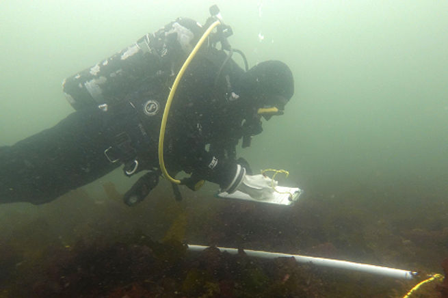
Photo: A KRI diver counting species abundance of kelp and invertebrates in the Salish Sea
PC:
For this project, PhD candidate Brian Timmer is resurveying historical data that he found in the University of Victoria Archives to investigate a half-century of change in the Strait of Georgia. This project is a part of KRI’s Aquatic Ecosystem Restoration Fund, and is also supported by National Geographic and the Royal Canadian Geographical Society's Trebek Initiative. In 2023, KRI partners at the Hakai Institute mapped the northwestern shoreline of the Strait of Georgia with their Airborne Coastal Observatory, which Brian is comparing to historical aerial imagery collected in 1972 to determine changes in bull kelp (Nereocystis) distribution. The same summer, Brian and his field team re-conducted intertidal and subtidal (SCUBA) surveys of nearly 100 species of seaweed, also originally conducted in 1972 to ground truth the aerial imagery that was collected.
1972
Summer
2020
Winter
2023
Spring
2023
Summer
2024
Aerial Imagery/ Ground Truth Surveys By Dr. Alan Austin
Historical Data Uncovered In UVic Archives
Project Funding Secured From National Geographic, The Trebek Initiative, and DFO AERF
Surveys Reconducted by KRI With Hakai Institute's Airborne Coastal Observatory
Data Processing/ Analysis, Historical Kelp Habitat Used To Identify KRI restoration sites
2025
Results Will Be Published